
Soil Borings Florida
A boring is not paperwork. It is the only direct measurement anyone on the project will ever have of what is actually under the site. Everything downstream, the footing size, the wall section, the pond bottom, the pavement section, is calculated from numbers that come out of these holes.
Which is why the program gets designed rather than ordered. Depth, spacing, sampling interval and the laboratory suite are chosen against the question the project is asking, and the field work and the testing are run to methods a reviewing engineer can look up.

What comes back from the field
- Soil profile and stratification by depth
- Penetration resistance, the N value, at each sampled interval
- Groundwater at drilling and after stabilization
- Depth to competent material or refusal
- Recovered samples for laboratory classification and testing
What it is used to design
- Foundations, shallow and deep
- Retaining walls and earth retention
- Retention and detention ponds
- Pavement and roadway subgrade
Start with the address
Send the address, the survey and what you are building. We will tell you what the exploration needs to cover before anyone mobilizes a rig.
Office 813-614-1718
Four Designs Come Out of the Same Boring Program
Most people order borings for one reason and then discover they needed them for four. On a typical Florida site the same subsurface data feeds the foundation, the earth retention, the stormwater design and the pavement section. Scoping the exploration once, for all four, costs less than drilling the site twice and produces a report that does not contradict itself.
Foundation Design
Bearing stratum and its depth, allowable bearing pressure, settlement estimates, and whether the ground will carry a shallow footing or the load has to be taken to a deep foundation. Penetration resistance and laboratory strength and consolidation data drive all of it.
Retaining Wall Design
Shear strength and unit weight of the retained soil, the foundation soil under the wall, and the groundwater behind it. Those three set the earth pressure, the sliding and overturning check and the drainage detail on a retaining wall or a sheet pile section.
Retention and Detention Pond Design
Seasonal high groundwater and the infiltration or exfiltration rate. A pond is sized from those two numbers, and a wet season water table higher than the design assumed is the most common reason a system does not recover between storms.
Pavement and Roadway Subgrade
Subgrade classification, support characteristics, depth to water below the pavement section and whether the existing material can be reused or has to be removed and replaced.
Seawalls and Waterfront Work
Embedment, passive resistance, scour exposure and the tidal groundwater range behind a seawall or bulkhead, where the water condition is a moving number rather than a fixed one.
Karst and Void Screening
Loose zones, raveled soil, sudden drops in resistance and irregular limestone surface, the indicators that decide whether a site needs further investigation before a foundation type is named.
Standard Penetration Test Borings
We perform Standard Penetration Test borings to ASTM D1586/D1586M, the Standard Test Method for Standard Penetration Test and Split-Barrel Sampling of Soils. The method drives a two inch split-barrel sampler with a 140 pound hammer falling 30 inches, and it returns two things at once: a measurement and a sample.
The sampler is driven three successive six inch increments. The blows for the second and third increments are added together, and that sum is the Standard Penetration Resistance, the N value:
- B2, blows for the second six inch increment
- B3, blows for the third six inch increment
- N, the Standard Penetration Resistance value
The first increment is excluded because it drives through material disturbed by the drilling itself. Higher N values generally indicate denser or stronger soil, lower values loose or compressible material. The raw number is not the answer on its own, though, which is the next part.
How a Boring Runs
- Advance hollow stem augers to the first test depth
- Insert the split-barrel sampler
- Drive it with the 140 pound hammer and 30 inch drop
- Record the blows for each six inch increment
- Recover the sample, log it and seal it for the laboratory
- Advance to the next test interval
- Record groundwater at drilling and again after stabilization
- Continue to design depth or to refusal
- Grout the hole on completion
Sampling is commonly at five foot intervals below the shallow zone, tighter near the surface where the foundation influence is greatest, and tighter again wherever the log starts changing quickly.

Other Exploration Methods, and When Each One Earns Its Place
SPT is the backbone, but it is not always the right tool on its own. The method gets matched to the question, the access and the soil.
Cone Penetration Testing
Electronic friction cone and piezocone testing to ASTM D5778. A continuous record of tip resistance, sleeve friction and pore pressure rather than readings every five feet, which is why it is strong for thin layers, loose zones and soft ground that SPT can step over.
Hand Auger Exploration
Shallow work where a rig cannot reach or is not warranted: interior spaces, tight side yards, pond bottoms, pavement cores and shallow infiltration testing.
Rock Coring
Where the design has to prove competent rock rather than assume it. Coring recovers the material, shows the condition of it, and distinguishes a continuous bearing surface from a boulder or a ledge.
Groundwater Observation
Readings at drilling and after stabilization, with piezometers where the design needs the range across a season rather than one morning.
Infiltration and Permeability Testing
Field measurement for stormwater and pond design, run alongside the boring program so the infiltration rate and the seasonal high come from the same investigation.
Undisturbed Sampling
Thin wall tube sampling where consolidation or strength testing is needed on material that has to reach the laboratory in the condition it was in the ground.
How We Choose a Laboratory, and Why It Is a Specification Rather Than a Phone Call
Field work produces samples. What those samples are worth depends entirely on where they go next. We use accredited laboratories in Florida for the testing behind our reports, and accreditation here means something specific and checkable rather than a logo on a letterhead.
What AASHTO Accreditation Actually Requires
The AASHTO Accreditation Program states its objective as providing a mechanism for formally recognizing a testing agency conformance to standards and the competency of a testing agency to perform specific tests on construction materials. It is overseen by the AASHTO re:source Administrative Task Group, part of the AASHTO Committee on Materials and Pavements.
Three things stand behind it:
- A quality management system meeting AASHTO R 18, established, implemented and maintained
- An on site assessment, where assessors evaluate the equipment and observe the physical demonstration of the practices and tests
- Participation in the AASHTO re:source and CCRL proficiency sample programs for every method in the accredited scope
Two Details Worth Knowing as an Owner
Accreditation is by test method, not by building. A laboratory is accredited for a defined scope. A firm can be accredited and still not be accredited for the specific test your project needs, so the question to ask is whether the method on your report is inside their scope.
Standards get withdrawn. ASTM D422, the old particle size analysis method, was withdrawn in 2016 and is now covered by D6913/D6913M for sieve analysis and D7928 for the sedimentation, or hydrometer, analysis. A report still citing a withdrawn method is a signal about how closely anybody is reading.
The Tests, and What Each One Decides
A laboratory suite is selected against the design questions the project has, not run as a fixed package. This is the working list and what each result is actually used for.
Classification
Soil classification for engineering purposes to ASTM D2487, the Unified Soil Classification System, which sorts soil from particle size characteristics, liquid limit and plasticity index. It is the common language every downstream design is written in.
Gradation
Particle size distribution by sieve analysis to ASTM D6913/D6913M, and by sedimentation to ASTM D7928 where the fines fraction matters. Drives classification, filter and drainage design, and reuse decisions.
Atterberg Limits
Liquid limit, plastic limit and plasticity index on the fine grained fraction. These separate a workable silty sand from a clay that will shrink, swell and argue with a slab for the life of the building.
Moisture Content
Natural water content, run on essentially everything, because it anchors the interpretation of strength, density and compressibility results from the same sample.
Organic Content
Organic and peat identification. Organic layers are highly compressible and generally unsuitable for support, so finding their depth and thickness usually changes the foundation decision rather than refining it.
Consolidation
One dimensional consolidation to ASTM D2435/D2435M, incremental loading. This is where settlement magnitude and settlement rate come from, which is the difference between predicting movement and being surprised by it.
Shear Strength
Direct shear and triaxial testing for the strength parameters behind bearing capacity, slope stability and earth pressure on a wall. The retaining wall section is only as good as these numbers.
Compaction
Moisture density relationships for fill specification and field acceptance, so what gets built matches what was designed and the compaction testing has something to be measured against.
Permeability and Infiltration
Laboratory permeability alongside field infiltration testing. On a stormwater or pond design this and the seasonal high groundwater are the two inputs the whole system is sized from.
Corrosivity
pH, resistivity, chloride and sulfate screening where buried steel or concrete is going into the ground, particularly on coastal and waterfront work where the exposure decides the material.
Rock Testing
Core logging, recovery and rock quality designation, with unconfined compressive strength where a design is bearing on or socketing into rock rather than passing through it.
Subgrade Support
Bearing ratio and subgrade support testing for pavement and roadway sections, including whether existing material can be reused in place or has to come out.
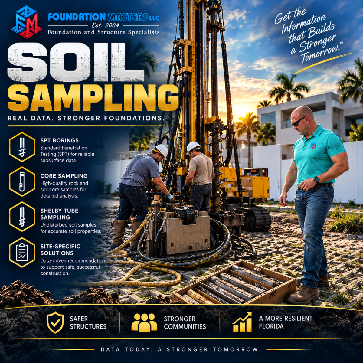
What the Borings Usually Find in Florida
Florida geology varies sharply across the state and frequently across a single parcel. These are the materials that recur, and what each one means for a design.
- Clean sands, good bearing when dense, a settlement problem when loose, and the difference is measured rather than assumed
- Silty and clayey sands, variable strength and variable permeability, which matters as much to the pond as to the footing
- Clays, where plasticity and shrink swell behavior drive the slab and footing decisions
- Organic soils and peat, highly compressible, generally unsuitable for support, and expensive to discover late
- Fill, of unknown age, source and density, common anywhere the ground was raised once
- Limestone, at depths that vary by region and by parcel, sometimes continuous and sometimes not
- Karst indicators, loose zones, raveled soil and an irregular rock surface

Subsurface Exploration · Sampling · Florida Geotechnical Conditions
What the Report Contains
- Boring location plan and surface elevations
- Logs showing the soil profile, stratification and sample depths
- Penetration resistance values at each sampled interval
- Soil classifications and laboratory results
- Groundwater observations at drilling and after stabilization, with the seasonal high interpretation and the basis for it
- Depth to competent material, rock surface elevation and refusal depths
- Bearing capacity and settlement analysis
- Foundation recommendations and alternatives
- Earthwork, fill and site preparation recommendations
- Construction considerations, including excavation and dewatering

Projects That Normally Need Borings
- New residential construction and structural additions
- Commercial, industrial and municipal development
- Retaining walls, seawalls and earth retention
- Deep foundation systems and underpinning
- Retention and detention pond design
- Roadway, pavement and site drainage work
- Bridge and infrastructure construction
- Void and subsidence investigations
- Due diligence before a purchase closes
Many Florida jurisdictions require a geotechnical report before a structural permit is issued on larger or more complex projects, and requirements vary by authority. Confirm the current requirement with the reviewing agency for your project.
Soil Borings in Florida: Common Questions
How many soil borings does a project need?
It depends on the structure, the footprint, the loads and what the site history turns up. A small residential project may need one to three. A larger commercial development can need many more, laid out to characterize variability across the footprint rather than clustered where access was easy. Placement usually matters more than count, and anyone quoting a number before seeing the site is pricing a package rather than answering a question.
How deep do Florida soil borings go?
Depth is set by the structure and the loads, not by a rule of thumb. Light residential work is often in the range of 15 to 40 feet. Heavier structures, deep foundation design and void investigations regularly go substantially deeper, because the exploration has to reach below the depth at which the load still influences the soil.
What is an N value?
It is the Standard Penetration Resistance from an ASTM D1586/D1586M test. A two inch split-barrel sampler is driven three six inch increments with a 140 pound hammer falling 30 inches, and the blows for the second and third increments are added together. That sum is N. Higher values generally mean denser or stronger soil.
Why is the first six inches not counted?
Because it drives through material disturbed by the drilling that got the sampler to that depth. Counting it would flatter the result. The second and third increments are in soil the drilling has not already loosened.
Can two rigs get different N values in the same soil?
Yes, and it is worth understanding why. The energy actually delivered to the drill rod varies with the hammer system, so the recorded count is not an absolute property of the soil. A competent interpretation accounts for that rather than treating the field number as fixed.
What is the difference between SPT and CPT?
SPT gives a measurement and a physical sample at intervals, commonly every five feet below the shallow zone. Cone penetration testing to ASTM D5778 pushes an instrumented cone continuously and records tip resistance, sleeve friction and pore pressure the whole way down, so it resolves thin layers and soft zones that a five foot sampling interval can step over. It does not recover a sample. The two are often run together.
Do you do the laboratory testing yourselves or send it out?
We use accredited laboratories in Florida for the testing behind our reports. Accreditation under the AASHTO Accreditation Program requires a quality management system meeting AASHTO R 18, an on site assessment where assessors observe the practices and tests being performed, and participation in proficiency sample programs with z-scores of 2.00 or less for every method in the accredited scope.
Does an accredited laboratory mean every test they run is accredited?
No, and this is a useful thing to know. Accreditation is granted for a defined scope of test methods. A laboratory can be accredited and still not hold accreditation for the specific method your project needs. The question worth asking is whether the method named on your report sits inside their scope.
Which standards do you test to?
Classification to ASTM D2487, the Unified Soil Classification System. Gradation by sieve to ASTM D6913/D6913M and by sedimentation to ASTM D7928. Consolidation to ASTM D2435/D2435M. Field penetration testing to ASTM D1586/D1586M and cone testing to ASTM D5778. The suite is selected against the design questions rather than run as a fixed package, and we keep the designations current because standards do get withdrawn and replaced.
What do borings have to do with my retention pond?
Two numbers, and a pond is sized from both. The infiltration or exfiltration rate, and the seasonal high groundwater. A wet season water table higher than the design assumed is the most common reason a system does not recover between storms, and it is established by the same investigation that answers the foundation question.
Why does a retaining wall need soil data?
Because the earth pressure on the wall is calculated from the strength and unit weight of the soil behind it, the wall is founded on soil in front of and beneath it, and the groundwater behind it drives both the pressure and the drainage detail. Without measured strength parameters those are assumed values, and an assumed value is where a wall design either wastes money or fails.
Why do groundwater levels matter so much?
They affect bearing capacity, buoyancy and uplift, excavation stability, the dewatering requirement and the long term performance of anything below grade. A single depth recorded on a drilling day is a measurement. The seasonal high is an interpretation, and it is the one the design actually needs, so the basis for it belongs in the report.
Can soil borings identify sinkholes?
They can identify the indicators, which is a different and more honest claim. Loose zones, raveled soil, sudden losses of resistance and an irregular limestone surface are the conditions associated with karst activity. Where those show up, the borings tell you further investigation is warranted rather than telling you a sinkhole is present.
Does every Florida site have limestone near the surface?
No. Depth to limestone varies substantially by region and by parcel, and on some sites it is well below anything the project cares about. That is precisely why it gets measured rather than assumed from what the neighbors found.
How do I get borings scheduled?
Send the address, the survey, any plans you have, and what you are building, including whether there is a wall, a pond or pavement in the scope. We will lay out the program, tell you what it will establish, and price it before anyone mobilizes a rig.
What the Boring Data Feeds
Subsurface exploration sits upstream of most of what we do. These are the services the data goes into, all under the same roof, which is the reason a soil question and a foundation question do not have to be investigated by two different companies.
Geotechnical Engineering Florida
The statewide hub for subsurface investigation, foundation engineering and sinkhole evaluation.
Deep Foundation Systems
Pile and pier systems for sites where the ground will not carry a shallow foundation.
Civil Engineering Florida
Drainage, stormwater, pond and site development engineering, sized from the same subsurface data.
Structural Engineering Florida
Structural engineering that designs to the bearing values the borings establish.
Foundation Inspection Florida
Licensed evaluation for settlement, cracking and pre purchase questions, statewide.
Foundation Repair Florida
Repair engineering tied back to what the subsurface data actually shows.
Sheet Piling Contractors
Driven sheet piling for retention, cofferdams and shoreline work, installed with our own equipment.
Helical Piers
Foundation support and underpinning where load has to transfer to a deeper stratum.
Pipe Pile
Driven pipe pile for high loads and for sites where the bearing stratum is well below the footing.
Limestone Drilling Contractor Florida
Drilling through and into Florida limestone where a design has to reach and prove competent rock.
Seawall Contractor
Seawall and shoreline stabilization, designed against measured soil and tidal groundwater.
Drainage and Waterproofing Florida
Engineer led help for groundwater, runoff, slab moisture and water intrusion.
Standards and Accreditation References
The published sources behind the methods and accreditation language on this page. Worth reading directly rather than taking any summary of them on trust, this one included.
- ASTM International, for the current status and full text of every designation named above
- AASHTO re:source, which administers the AASHTO Accreditation Program and the proficiency sample programs
- Florida Geological Survey, for the geological context behind Florida soils, limestone and karst
- Florida Board of Professional Engineers
Where We Drill
We mobilize for subsurface exploration throughout the state, with market pages carrying the local geology and the conditions that drive the foundation decision in each.
- Tampa and the Gulf coast
- Orlando and Central Florida
- Miami and South Florida
- Jacksonville and Northeast Florida
Schedule Soil Borings in Florida
Send the address, the survey and what you are building. We will lay out the exploration program, tell you what it will establish and what it will support, and price it before anyone mobilizes a rig.
Foundation Masters, LLC
Geotechnical, civil and structural engineering, subsurface exploration and deep foundation installation, throughout the State of Florida.
Florida CA: 30969
Phone: 813-614-1718
Email: [email protected]