
Geotechnical Engineering Jacksonville for Coastal Plain Soils, Riverfront and Foundation Design
Northeast Florida is the part of the state where the governing question is usually the water rather than the rock. Loose sands, clay lenses, organics near the river, and a water table that does not sit still, because the St. Johns is tidal all the way through Jacksonville and well past it.
We help Jacksonville area clients with:
- Subsurface exploration: SPT borings, CPT soundings, rotary wash
- Foundation and coastal engineering design
- Sinkhole investigation and risk mitigation
- Ground improvement and soil stabilization
- Seawall and shoreline stabilization
- Groundwater control and dewatering design
- Forensic geotechnical investigations

Northeast Florida, from one firm
- Florida Certificate of Authorization CA 30969
- Investigation, design and installation under one roof
- Duval, Clay, St. Johns and Nassau counties
What we establish before a foundation is named
- Seasonal high groundwater, and how far the tide moves it
- Depth and variability of organics and soft layers
- Bearing stratum and whether it holds across the footprint
- Fill history on a parcel that was likely raised once
- Chloride exposure on sites near the lower river
Talk to us before design
Send the address and the site history. We will tell you what the investigation needs to cover before anyone spends money designing to the wrong assumption.
Office 813-614-1718
Here the Water Table Is the Moving Part, Not the Rock
Every Florida market has a different thing that decides the job. In Tampa Bay it is karst under a sand cover. In Central Florida it is how thin the clay above the limestone has become. In Northeast Florida the picture flips: the confining layer is thick, the aquifer below it is well separated from the surface, and what moves is the water at the top.
A Thick Confining Unit Changes the Question
The St. Johns River Water Management District maps recharge to the Upper Floridan aquifer partly by the thickness of the intermediate confining unit, a layer of low permeability clay and silt. Its mapping notes that the unit is thicker, greater than 100 feet, in the northern and southern areas of the district, resulting in low recharge rates of 1 to 5 inches per year.
Duval, Clay, St. Johns and Nassau sit in that northern part. So the surface and the deep limestone are further apart here than they are an hour and a half south, and the scope of a geotechnical investigation reflects that.
And the River Runs Backwards Twice a Day
The United States Geological Survey is direct about it. All sites on the main stem of the St. Johns River have substantive tidal influence, which is why the agency tidally filters its calculated discharge there. Tidal effects are recorded as far upstream as Astor, around river mile 127.
The flow itself reverses. USGS designates ebb, meaning seaward, flow as positive and flood, meaning landward, flow as negative, and it records substantial negative discharge at Jacksonville. That is not a curiosity. It is a groundwater condition.
Which is why a single depth to water on a Jacksonville boring log is close to meaningless on its own. On a riverfront or near river parcel the water table has a range, driven by season and by tide, and the design needs the envelope rather than the reading. Sizing a dewatering plan or setting a slab elevation off one number recorded on one morning is how a project finds out the hard way.
Built for Northeast Florida Soils, Groundwater and Riverfront Sites
Services
We provide geotechnical engineering and construction management for subsurface exploration, foundation and coastal design, ground improvement, dewatering and forensic investigation across Duval, Clay, St. Johns, Nassau and surrounding counties.
Clients
We work with homeowners, developers, contractors, attorneys, and commercial and municipal owners on riverfront, coastal and difficult soil projects throughout Northeast Florida.
Approach
We focus on verified subsurface data and durable foundation design so the solution holds up in Jacksonville coastal plain, tidal and high groundwater conditions.
Why Jacksonville Clients Choose Us
We do not treat a soil report as a box to check. We connect subsurface data to the foundation, the groundwater, the coastal or riverfront exposure, and the long term performance of the structure.
- Identify subsurface risks early, including organics, soft layers and seasonal high groundwater
- Recommend durable, cost effective foundation solutions
- Help prevent construction issues, water intrusion and settlement problems common in Northeast Florida
- Treat the tidal range as part of the groundwater answer rather than a footnote
Jacksonville Geotechnical Engineering Services
We handle exploration, foundation and coastal engineering, ground improvement, groundwater control and forensic investigation throughout Jacksonville and Northeast Florida.
Site Feasibility and Due Diligence
Feasibility studies and geotechnical due diligence to evaluate subsurface risk before design and purchase, while the deal can still be priced around what is in the ground.
Subsurface Exploration
SPT borings, CPT soundings and rotary wash drilling to characterize sands, marl, limestone and groundwater.
Tidal Groundwater Characterization
Establishing the range the water table actually moves through on a near river parcel, rather than the single depth a boring log records on one morning.
Foundation and Coastal Engineering
Foundation and coastal design matched to Jacksonville soils, tidal influence and riverfront conditions.
Ground Improvement
Stone columns, soil cement mixing and pressure grouting for weak, organic or variable ground.
Seawall and Shoreline Stabilization
Geotechnical support for seawall and shoreline stabilization along coastal and riverfront sites.
Groundwater Control and Dewatering
Groundwater control system design and dewatering planning for excavations below the water table, sized against a range rather than a point reading.
Deep Foundations and Underpinning
Design support for pipe pile, pile driving, and helical or push pier systems.
Pavement and Roadway Subgrade
Pavement subgrade analysis and roadway foundation recommendations for durable, long performing surfaces.
Sinkhole Investigation Where It Applies
Screening, confirmatory drilling and remediation design where the geology or the site history calls for it, reported to the standard Florida law sets.
Construction Phase Support
Earthwork observation, fill evaluation, compaction review, pile monitoring and the field calls that have to be made while the excavation is open.
Forensic Geotechnical Engineering
Forensic investigations and expert witness support for settlement, erosion and failed foundations, with a written opinion on cause.

SPT and CPT Exploration · Subsurface Data · Northeast Florida Geology
Jacksonville Soils, Geology and Riverfront Conditions
Jacksonville geology includes variable sands, clays and limestone, with shallow groundwater and organic rich soils along the St. Johns River and the Intracoastal Waterway. These conditions demand engineered solutions for stability, drainage and long term settlement resistance.
Our engineers have completed projects across Riverside, San Marco, Ponte Vedra, St. Augustine, Atlantic Beach and other coastal and riverfront sites, where tidal influence, saltwater intrusion and fluctuating groundwater all affect foundation performance.
Much of the developed ground near the river was also raised at some point. Where the fill came from, how deep it goes and what is underneath it are three separate answers, and none of them appear on a plat.
Resilient Coastal and Riverfront Foundation Support
We engineer solutions that withstand Jacksonville tidal influence, flood events and long term coastal settlement pressures.
- Vibro compaction and vibro replacement using stone columns
- Soil mixing and cement stabilization of organic soils
- Seawall stabilization and coastal foundation design
- Groundwater control through dewatering systems and barriers
- Underpinning and retrofitting existing coastal structures
- Driven sheet piling for retention, cofferdams and shoreline work
Land Surveying and Subsurface Exploration
- Boundary and topographic surveys
- ALTA and NSPS land title surveys
- GPS and high definition 3D laser scanning
- Construction layout and as built quality control surveys
- Wetland delineation and hydrographic mapping
- Geophysical surveys, including ground penetrating radar, electrical resistivity and seismic imaging
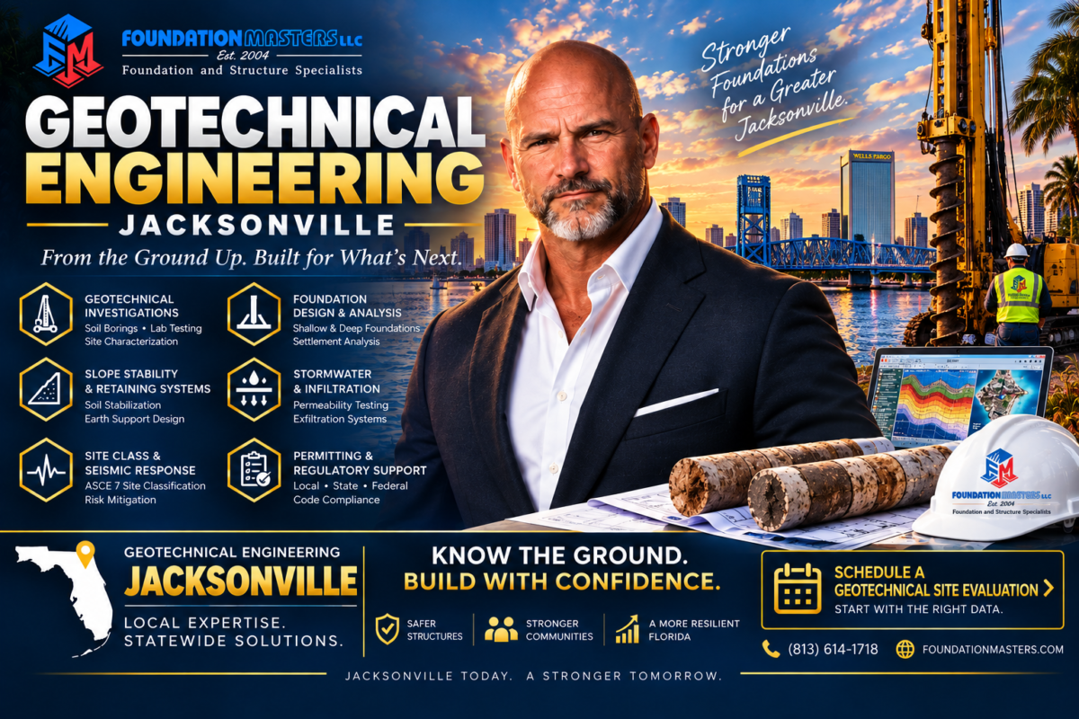
What the Investigation Has to Establish on a Northeast Florida Parcel
The methods travel. The question the investigation is trying to settle does not. A scope written for one Florida market and reused in another usually collects the right data about the wrong risk, which is the most expensive kind of complete report. These are the answers a Jacksonville project generally needs before a foundation type is named.
The Ground and the Water
- Bearing stratum, its depth and whether it is continuous across the footprint rather than present at one boring
- Seasonal high groundwater as a range, since on a near river parcel the tide is part of that range
- Depth and variability of organics and soft compressible layers under anything carrying load
- Fill history, because a site that was raised once behaves differently from one that never was
- Erosion and scour exposure on shoreline and bulkhead work
- Chloride exposure where the site sits near the brackish reach of the lower river
- Whether excavated material can be reused on site, which is a budget question answered by a laboratory
What Changes the Scope
Placement, not just count. Exploration spread to characterize the whole footprint and its variability answers more questions than the same number of holes clustered where access happened to be easy.
Proximity to the river or the Intracoastal. It moves the groundwater work from a single reading to an interpreted range, and it usually brings an earth retention or shoreline question along with it.
And what gets written down when the data is ambiguous. Recording the uncertainty honestly, with what would resolve it, is worth more than a confident number nobody can trace back to a hole.
A Jacksonville Geotechnical Report Is Written Once and Read by Several Audiences
Most of the pressure on a geotechnical report does not come from the person who commissioned it. It comes from everyone who reads it later, usually under circumstances nobody planned for.
- The structural engineer, who designs to the bearing values and will ask what happens at the edge of the footprint where there was no boring
- The contractor, who prices the excavation and the dewatering from it and finds out on day one whether the water condition was right
- The building official, checking that the foundation design rests on something and not on an assumption
- The site civil engineer, who needs the same groundwater and infiltration data the foundation work produced
- The next engineer, years later, when something has moved and somebody wants to know what was known at the time
Foundation Alternatives for Northeast Florida Sites
- Spread footings where the bearing stratum is there and proven
- Deep foundations such as driven pile or drilled shafts
- Mat and ring foundation systems over variable ground
- Ground improvement and densification to enable shallow foundations
- Retaining structures, bulkheads and shoring support
- Groundwater control measures sized to a tidal range
Serving Geotechnical Projects Across Jacksonville and Northeast Florida
Foundation Masters delivers geotechnical engineering throughout Jacksonville and Northeast Florida, including communities across Duval, Clay, St. Johns and Nassau counties. Each area presents distinct soils, groundwater and coastal or riverfront conditions that shape foundation and site decisions.
Riverside and San Marco
Established neighborhoods close to the river, where additions and renovations sit on structures that have already found their level and the groundwater question arrives with the load question.
Downtown and the Northbank
Higher loads on tight sites with the river close enough that the excavation support and the dewatering plan have to be designed together.
Ponte Vedra and the Beaches
Coastal sands, dune systems and salt exposure, where scour and erosion belong in the scope alongside bearing and settlement.
St. Augustine and St. Johns County
Rapid growth over ground that varies quickly, so characterizing variability across a large footprint matters more than confirming one assumed profile.
Clay and Nassau Counties
Newer development at scale, where the early exploration decides how much of the site work has to be redesigned later.
Riverfront and Intracoastal Parcels
Bulkheads, seawalls and near shore foundations, where the tidal range and the salinity are design inputs rather than background detail.
Geotechnical Engineering Jacksonville: Frequently Asked Questions
What does a geotechnical engineering firm do?
It investigates soil, rock and groundwater conditions to support safe and cost effective foundations, seawalls, retaining walls and ground improvement. On a Northeast Florida site that usually means establishing the bearing stratum, the depth and variability of organics, and what the water table does across a season and a tide cycle.
When should I hire a geotechnical engineering firm in Jacksonville?
If you are planning new construction, dealing with coastal or riverfront erosion, or looking at existing foundation settlement, the site should be evaluated before construction or repair begins. The work earns its money during due diligence and design. A correction made in the field happens at the contractor rate, after the schedule is already committed.
Do Jacksonville soils require special foundation design?
Often yes. Loose sands, clay lenses, organics and high groundwater can require deep foundations, underpinning, dewatering or ground improvement to meet the Florida Building Code and long term performance goals. Whether your parcel is one of those is decided by the exploration.
Is sinkhole risk the main concern in Jacksonville?
Usually not the way it is in Tampa Bay or Central Florida, and the geology explains why. The St. Johns River Water Management District describes the intermediate confining unit, the clay and silt layer above the Upper Floridan limestone, as thicker, greater than 100 feet, in the northern and southern areas of the district, resulting in low recharge rates of 1 to 5 inches per year. Duval, Clay, St. Johns and Nassau sit in that northern part. We still screen where the geology or the site history calls for it, and we still do sinkhole work, but we do not sell a Tampa scope here.
Why do you keep talking about the tide on a foundation page?
Because it is a groundwater condition. The United States Geological Survey states that all sites on the main stem of the St. Johns River have substantive tidal influence, which is why it tidally filters its calculated discharge there, with tidal effects recorded as far upstream as Astor around river mile 127. The flow itself reverses, and the agency records substantial landward flow at Jacksonville. Near the river that movement reaches the water table.
So what is my seasonal high groundwater, really?
On a near river parcel it is a range rather than a number. A single depth to water recorded on a drilling day is a measurement. The design needs the envelope it moves through, driven by both season and tide, and the basis for that interpretation belongs in the report rather than in the memory of whoever drilled it.
Is salt a problem for foundations here, or only in South Florida?
It is a real question on the lower river and at the beaches. Annual mean salinity in the lower St. Johns decreases with distance upstream, and near the mouth at the Dames Point Bridge it has been reported around 22 to 23 parts per thousand. Where a site sits in that reach, chloride exposure belongs in the material and protection decisions.
Do I need dewatering?
Frequently, for excavations below the seasonal high water table. We design temporary and permanent groundwater control to manage inflow and uplift, and on a near river site we size it against the range the water actually moves through rather than a single reading.
What exploration methods do you use?
SPT borings, CPT soundings and rotary wash drilling, with laboratory testing, groundwater monitoring and geophysical survey where the question calls for it. The scope is chosen against what the project is trying to settle rather than run as a fixed package.
How many borings does my Jacksonville project need?
There is no fixed number, and anyone who quotes one before seeing the site is pricing a package rather than answering a question. The layout is driven by the structure, the footprint, the loads, the known geology and what the historical review turns up. Placement usually matters more than count.
Do you handle coastal and riverfront projects?
Yes. We support seawall and shoreline stabilization, coastal and riverfront foundation design, and dewatering for waterfront sites along the St. Johns River and the coast, and we install sheet piling and deep foundations with our own crews.
Do you install what you recommend?
Yes, on much of it. We install helical piers, deep foundation systems, pipe pile and sheet piling with our own crews. That changes what gets recommended, because the people writing the recommendation know what can actually be installed on that site at the price it was budgeted at.
Can you support the project during construction?
Yes. We provide geotechnical support during construction, including earthwork observation, fill evaluation, compaction review, pile monitoring and the field calls that have to be made while the excavation is still open.
Can a geotechnical report improve property value?
A documented soil and foundation evaluation helps owners, buyers, lenders and project teams understand subsurface risk and foundation performance before the decision is made rather than after. On a waterfront parcel it is frequently the document the transaction turns on.
How do I start a project with Foundation Masters?
Send the address, the survey, any plans, permits or photographs you have, the known site history and what you are trying to achieve. We will tell you what the investigation actually needs to cover before anyone spends money designing to the wrong assumption.
Related Florida Engineering and Foundation Services
This page connects to related services involving soils, foundations, deep foundation systems, structure and coastal work.
Geotechnical Engineering Florida
The statewide geotechnical hub for subsurface exploration, foundation design and ground improvement.
Foundation Repair Jacksonville
Jacksonville foundation repair for settlement, cracking and structural movement, engineered from the cause.
Structural Engineering Jacksonville
Structural engineering coordinated with subsurface data for repair, retrofit and new construction.
Civil Engineering Jacksonville
Drainage, stormwater, grading and site development engineering for Jacksonville properties.
Seawall Contractor
Seawall and marine support for shoreline and riverfront stabilization.
Sheet Piling Contractors
Driven sheet piling for retention, cofferdams and shoreline work, installed with our own equipment.
Pipe Pile
Driven pipe pile deep foundations for heavy loads, poor soils and difficult subsurface conditions.
Pile Driving Contractors
In house pile driving for residential, commercial and industrial deep foundations statewide.
Helical Piers
Helical pier systems for underpinning, settlement repair and support in variable soils.
Soil Borings
The investigation itself, including the groundwater and infiltration data most Florida designs are sized from.
Foundation Inspection Florida
Evaluations for settlement, cracking and pre purchase inspection needs statewide.
Civil Engineering Florida
The statewide civil engineering hub for drainage, stormwater and site development.
Sources and Agency References
The primary sources behind the confining unit and tidal statements on this page. Worth reading directly rather than taking any summary of them on trust, this one included.
- St. Johns River Water Management District, Upper Floridan recharge mapping, including confining unit thickness and the recharge classes
- United States Geological Survey, lower St. Johns River discharge and salinity, on tidal influence, flow reversal and salinity by river reach
- Florida Geological Survey, for the geological context behind Florida limestone and karst
- Section 627.7072, Florida Statutes, testing standards for sinkhole investigation
- St. Johns River Water Management District, the permitting district for Northeast Florida
- United States Geological Survey, for regional geologic and groundwater reference
Leadership and Delivery
Our work is supported by leadership and a technical team with experience in geotechnical, structural, civil, forensic and construction facing disciplines, backed by in house deep foundation and ground improvement capability.
- Geotechnical engineering statewide in Florida
- Geotechnical engineering in Tampa
- Geotechnical engineering in Orlando
- Geotechnical engineering in Miami
Jeff Earl, CEO
Foundation Masters, LLC · Construction and Engineering Management
Florida CA: 30969
Office: 813-614-1718 · Direct: 656-233-7089
Email: [email protected]
Start Your Jacksonville Geotechnical Engineering Project
Planning a development, evaluating foundation risk or addressing subsurface challenges in Jacksonville or Northeast Florida? Foundation Masters provides exploration, foundation and coastal design, ground improvement, dewatering and forensic geotechnical support.
Foundation Masters, LLC
Geotechnical, civil and structural engineering, and deep foundation installation, throughout Northeast Florida and the State of Florida.
Phone: 813-614-1718
Service area: Duval, Clay, St. Johns and Nassau counties, and statewide.